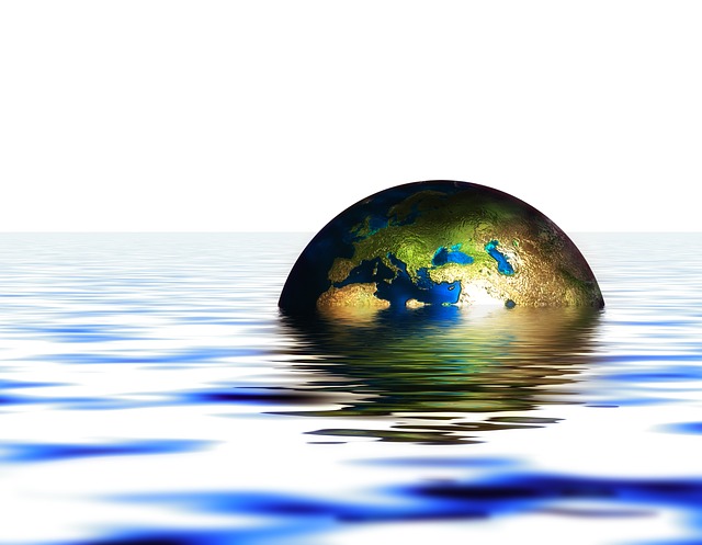
Laut dem Weltklimarat bleiben nur noch wenige Jahre, um wirksamen Klimaschutz einzuleiten. Doch schon 2007 hat der IPCC ein entsprechendes Ultimatum gestellt – das bereits 2015 abgelaufen ist, ohne dass schlimme Konsequenzen eingetroffen sind. Alex Reichmuth ging im Nebelspalter den zahlreichen ökologischen Weltuntergangs-Ankündigungen mit Ablaufdatum nach.
Weltuntergang mit Ablaufdatum
Es sei zwar spät, aber noch sei nichts verloren. Mit dieser Warnung trat vor kurzem der Weltklimarat (IPCC) an die Öffentlichkeit. Anlässlich der Publikation des sechsten Syntheseberichts teilte der IPCC mit, bis 2030 müsse der Ausstoss an Treibhausgasen halbiert werden, damit eine gefährliche Erderwärmung über 1,5 Grad noch verhindert werden könne (siehe hier).
Viele Medien verbreiteten das Ultimatum pflichtbewusst weiter. «Noch ist es nicht zu spät – aber die Zeit drängt», schrieben die Zeitungen von CH-Media (siehe hier). «Die Erde wird beim Klimawandel in der nächsten Dekade wohl eine kritische Schwelle überschreiten, wenn nicht eine drastische Wende eingeleitet wird», warnte die «New York Times» (siehe hier).
Mehr dazu im Nebelspalter.
+++
Brian Niemietz auf phys.org:
British scientists tracking two enormous icebergs larger than London
British scientists are tracking two enormous icebergs that broke off from Antarctica and could intrude on shipping lanes.
The smaller of the icebergs is called A81 and it’s bigger than Greater London, according to the BBC. Its larger travel companion is called A76a.
The Royal Research Ship Discovery inspected the latter berg as it entered the southern Atlantic Ocean.
„It was directly in our path as we sailed home so we took 24 hours out to go around it,“ British oceanographer Geraint Tarling told the BBC. It’s slowly approaching the Falkland Islands, which are a British territory. Researchers‘ biggest concern is that A76a would get grounded and further break into smaller pieces that could obstruct shipping and fishing operations.
NASA said in October that a chunk of ice that broke from the world’s largest iceberg, A76, was floating in the Drake Passage off of Cape Horn, Chile. Such icebergs typically melt as they enter warmer waters near the equator.
A81 broke off Antarctica’s Brunt Ice Shelf in February after being weakly tethered to the mainland for years, according to The British Antarctic Survey.
Weiterlesen auf phys.org
+++
Hayley Smith auf phys.org:
‚Nature gave us a lifeline:‘ Southern California refills largest reservoir after wet winter
Following a series of winter storms that eased drought conditions across the state, Southern Californians celebrated a sight nobody has seen for several punishing years: water rushing into Diamond Valley Lake.
The massive reservoir—the largest in Southern California—was considerably drained during the state’s driest three years on record, with nearly half of the lake’s supply used to bolster minuscule allocations from state water providers.
But an extraordinarily wet winter allowed officials from the Metropolitan Water District of Southern California to turn on the taps in Hemet once again. Water transported from Northern California roared out of huge concrete valves Monday and into the blue lake at 600 cubic feet per second—marking an incredible turnaround for a region that only months ago had barely enough supplies to meet the health and safety needs of 6 million people.
Weiterlesen auf phys.org
+++
Patrick T. FALLON auf phys.org:
Ghost lake set to reappear as California hit again by rain
A lake that dried up 80 years ago looked set on Tuesday to reappear, as monster rainfall accumulated over California’s wet winter season overwhelms the state’s rivers.
Even as spring appeared in the northern hemisphere, there was no let-up for America’s most populous state, with forecasters predicting another 4 inches (10 centimeters) of rain and up to 4 feet (120 centimeters) of snow over the mountains.
„Another significant event… on top of everything that has come before is going to cause some major problems,“ meteorologist Daniel Swain said on Twitter.
In California’s Central Valley, authorities issued evacuation orders for residents of communities in Tulare County, where a lake that dried up around World War II was set to reappear.
„Increasingly serious high water prospects in what is shaping up to possibly be a record Kings River runoff season have led the US Army Corps of Engineers (USACE) Sacramento District to announce plans to begin a rare flood release into old Tulare Lakebed,“ said a statement from the King’s River Conservation District (KRCD).
Weiterlesen auf phys.org
+++
River longer than the Thames beneath Antarctic ice sheet could affect ice loss
An unexpected river found under the Antarctic ice sheet affects the flow and melting of ice, potentially accelerating ice loss as the climate warms.
The 460km-long river is revealed in a new study, which details how it collects water at the base of the Antarctic ice sheet from an area the size of Germany and France combined. Its discovery shows the base of the ice sheet has more active water flow than previously thought, which could make it more susceptible to changes in climate.
The discovery was made by researchers at Imperial College London, the University of Waterloo, Canada, Universiti Malaysia Terengganu, and Newcastle University, with the details published today in Nature Geoscience.
Co-author Professor Martin Siegert, from the Grantham Institute at Imperial College London, said, „When we first discovered lakes beneath the Antarctic ice a couple of decades ago, we thought they were isolated from each other. Now we are starting to understand there are whole systems down there, interconnected by vast river networks, just as they might be if there weren’t thousands of meters of ice on top of them.
„The region where this study is based holds enough ice to raise the sea level globally by 4.3m. How much of this ice melts, and how quickly, is linked to how slippery the base of the ice is. The newly discovered river system could strongly influence this process.“
Water can appear beneath ice sheets in two main ways: from surface meltwater running down through deep crevasses, or by melting at the base, caused by the natural heat of the Earth and friction as the ice moves over land.
However, the ice sheets around the north and south poles have different characteristics. In Greenland, the surface experiences strong melting over the summer months, where immense amounts of water channel down through deep crevasses called moulins.
In Antarctica, however, the surface doesn’t melt in sufficient quantities to create moulins, as the summers are still too cold. It was thought this meant that there was relatively little water at the base of the Antarctic ice sheets.
The new discovery turns this idea on its head, showing there is sufficient water from basal melt alone to create huge river systems under kilometers-thick ice.
The discovery was made through a combination of airborne radar surveys that allow researchers to look beneath the ice and modeling of the ice sheet hydrology. The team focused on a largely inaccessible and understudied area that includes ice from both the East and West Antarctic Ice Sheets and reaches the Weddell Sea.
That such a large system could be undiscovered until now is testament to how much we still need to learn about the continent, says lead researcher Dr. Christine Dow from the University of Waterloo.
She said, „From satellite measurements we know which regions of Antarctica are losing ice, and how much, but we don’t necessarily know why. This discovery could be a missing link in our models. We could be hugely underestimating how quickly the system will melt by not accounting for the influence of these river systems.
„Only by knowing why ice is being lost can we make models and predictions of how the ice will react in the future under further global heating, and how much this could raise global sea levels.“
For example, the newly discovered river emerges into the sea beneath a floating ice shelf—where a glacier extending out from the land is buoyant enough to begin floating on the ocean water. The freshwater from the river however churns up warmer water towards the bottom of the ice shelf, melting it from below.
Co-author Dr. Neil Ross, from the University of Newcastle, said, „Previous studies have looked at the interaction between the edges of ice sheets and ocean water to determine what melting looks like. However, the discovery of a river that reaches hundreds of kilometers inland driving some of these processes shows that we cannot understand the ice melt fully without considering the whole system: ice sheet, ocean, and freshwater.“
The existence of large under-ice rivers also needs to be taken into account when predicting the possible consequences of climate change in the region. For example, if summers warm enough to cause enough surface melt that the water reaches the base of the ice sheet, it could have large effects on the river systems, potentially tipping Antarctica to a Greenland-like state, where ice loss is much faster.
There are also potential feedback loops that would accelerate ice loss. For example, if the ice starts to flow faster as water accumulated at the base, then this will increase friction where the ice runs over dry land, which could increase the amount of basal melting and water produced.
The team are now looking to gather more data about all these mechanisms from surveys to apply their models to other regions and provide a better understanding of how a changing Antarctica could change the planet.
Paper: Christine Dow, Antarctic basal environment shaped by high-pressure flow through a subglacial river system, Nature Geoscience (2022). DOI: 10.1038/s41561-022-01059-1. www.nature.com/articles/s41561-022-01059-1
+++
University of Texas at Austin:
Climate change is closing daily temperature gap: Clouds could be the cause
Climate change is shrinking the difference between the daily high temperature and the daily low in many parts of the world. The gap between the two, known as the diurnal temperature range (DTR), has a significant effect on growing seasons, crop yields, residential energy consumption and human health issues related to heat stress. But why and where the DTR shrinks with climate change has been something of a mystery.
Researchers who are part of a new international study that examined the DTR at the end of the 20th century believe they have found the answer: An increase in clouds, which blocks incoming-shortwave radiation from the sun during the day.
This means that while both the daily maximum temperature and the daily minimum are expected to continue to increase with climate change, the daily maximum temperature will increase at a slower rate. The end result is that the DTR will continue to shrink in many parts of the world, but that the changes will vary depending on a variety of local conditions, researchers said.
The study, published in the journal Geophysical Research Letters, is the first to use high-resolution computer modeling to delve into the issue of the Earth’s shrinking DTR, particularly how it is related to cloud cover.
„Clouds are one of the big uncertainties in terms of climate projections,“ said co-author Dev Niyogi, a professor at The University of Texas at Austin Jackson School of Geosciences. „When we do this with a very high spatial resolution modeling framework, it allows us to explicitly simulate clouds.“
Lead author Doan Quang Van, an assistant professor at the University of Tsukuba Center for Computational Sciences in Japan, said this is vital for understanding the future of the DTR.
„Clouds play a vital role in the diurnal temperature variation by modulating solar radiative processes, which consequently affect the heat exchange at the land surface, “ he said.
The team included scientists from the UT Jackson School’s Department of Geological Sciences, the National Center for Atmospheric Research in Boulder, Shanghai University of Engineering Science, National Defense Academy of Japan, and the University of Tsukuba in Japan. The modeling work used supercomputers at the University of Tsukuba Center for Computational Sciences.
Using the supercomputers, the team was able to model the complicated interplay of land-surface processes on climate change. These include changes in land use (such as deforestation), soil moisture, precipitation, cloud cover and other factors that can affect the temperature in a local region. By creating a model with a finer resolution grid—2 square kilometer grids rather than the 100-kilometer grids used in most climate models—the researchers were able to more closely analyze the impacts of climate change.
The team focused on two areas: the Kanto region of Japan and the Malaysian peninsula. They used the 10-year period from 2005-2014 as a baseline and then ran different climate scenarios to project what will happen to the DTR in the two regions at the end of the century. They found that the temperature gap closes by about .5 Celsius in the temperate Kanto region and .25 Celsius in the more tropical Malaysian peninsula. Researchers attribute these changes in large part to increased daytime cloud coverage that would be expected to develop under these climate conditions.
The researchers said the study can help scientists improve current global climate models and aid in understanding how the shrinking DTR will affect society and the environment as the climate continues to warm.
„It is very important to know how DTR will change in the future because it modulates human, animal and plant metabolisms,“ said Quang Van. „It also modulates the local atmospheric circulation such as the land-sea breeze.“
Paper: Quang‐Van Doan et al, Causes for Asymmetric Warming of Sub‐Diurnal Temperature Responding to Global Warming, Geophysical Research Letters (2022). DOI: 10.1029/2022GL100029